What follows is Emanuela's perspective of that day, with a bunch of tips for anyone looking to tackle the mighty Mauna Kea themselves.
Endure: to suffer (something painful or difficult) patiently
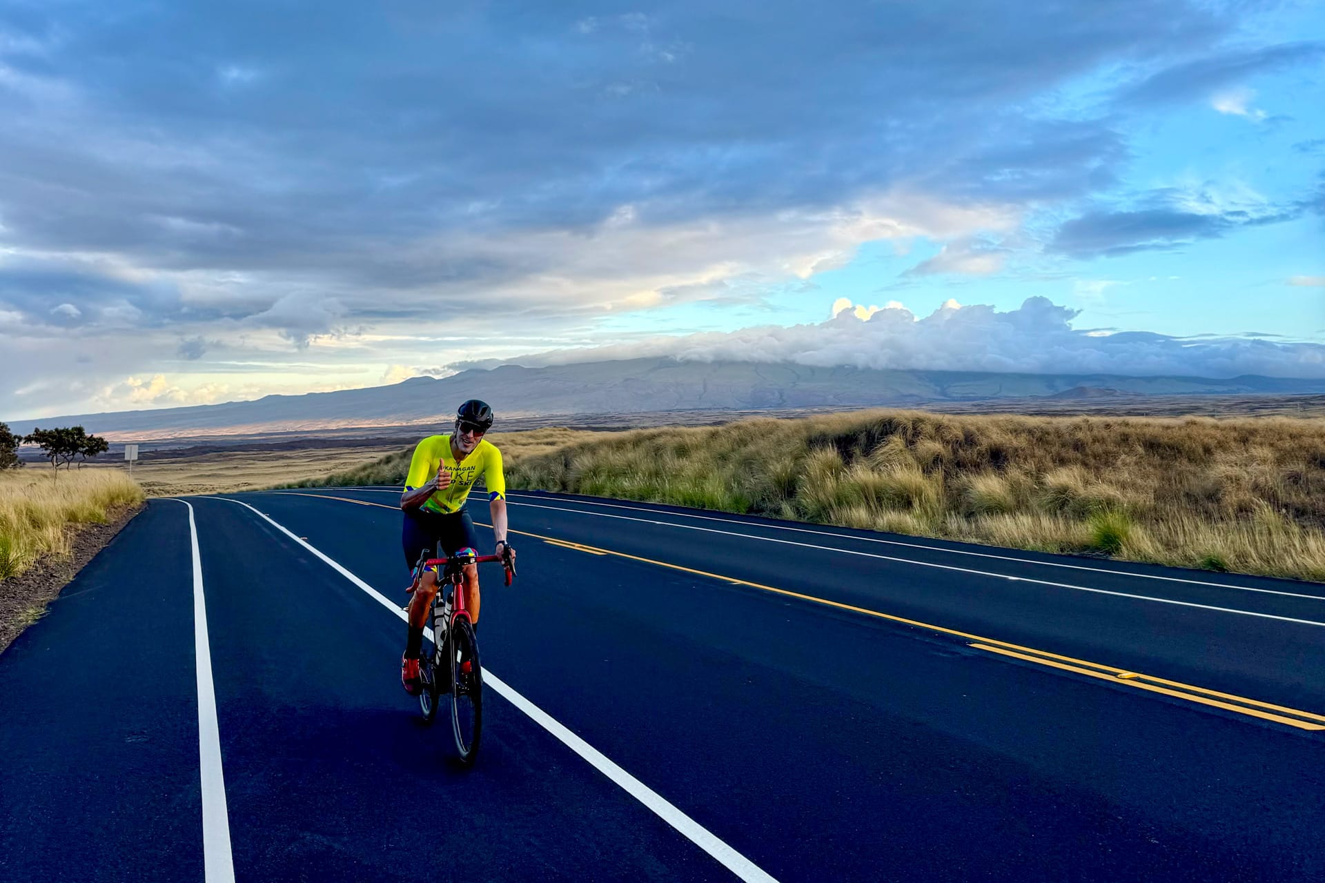
These are the best words to describe my husband Dalton's outstanding ascent to Mauna Kea’s summit this past January.
Dubbed as the world's biggest and hardest climb, Mauna Kea, Hawaii is particularly daunting due to its immense length, high altitude, steep gradients, unpredictable weather, and challenging road conditions. There are two official climbing segments: a shorter but steeper ascent from the eastern shores of the Pacific Ocean in Hilo, with a distance of 68 km/42 mi; or from the west side of the island in Waikoloa, a slightly longer distance of 89 km/55 mi. Both reach the Mauna Kea summit at 4,207m/13,803 feet above sea level.
This epic climb traverses five distinct climate zones, beginning in a lush rainforest and tropical environment and ending in the lunar landscape that dominates the final 16 km. At the summit, there is 42% less oxygen available than at sea level, and the final miles feature sustained gradients reaching up to 20%.
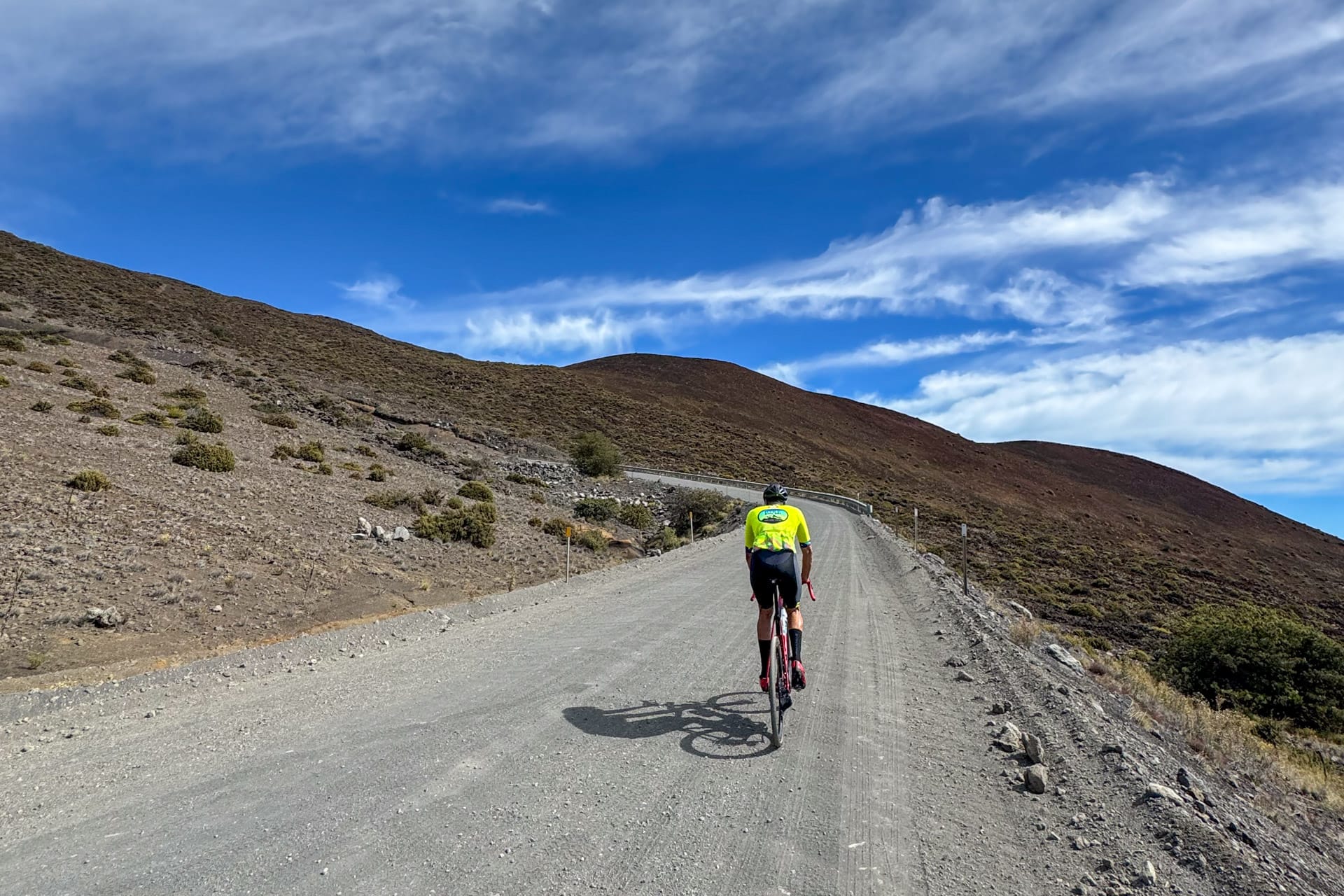
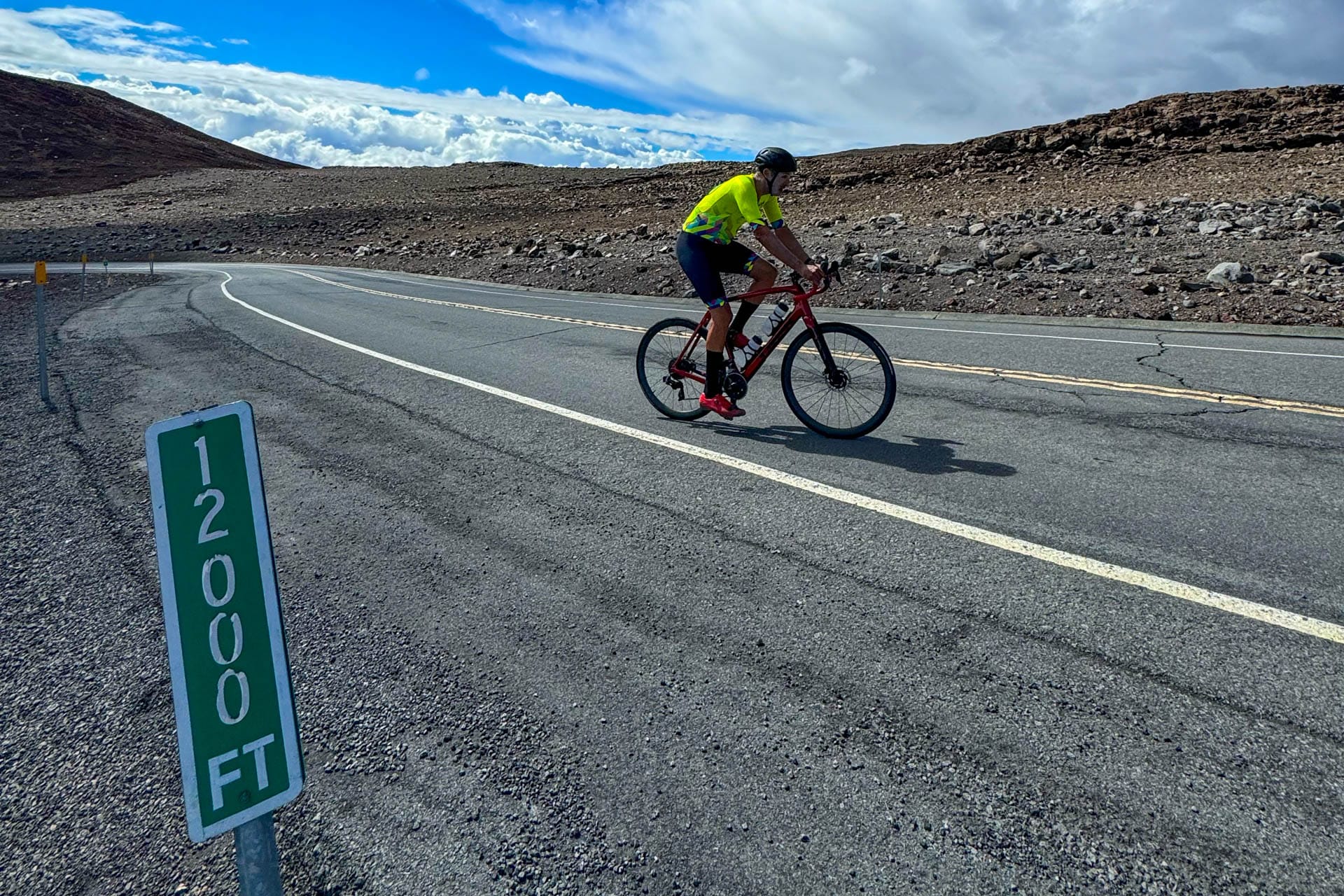
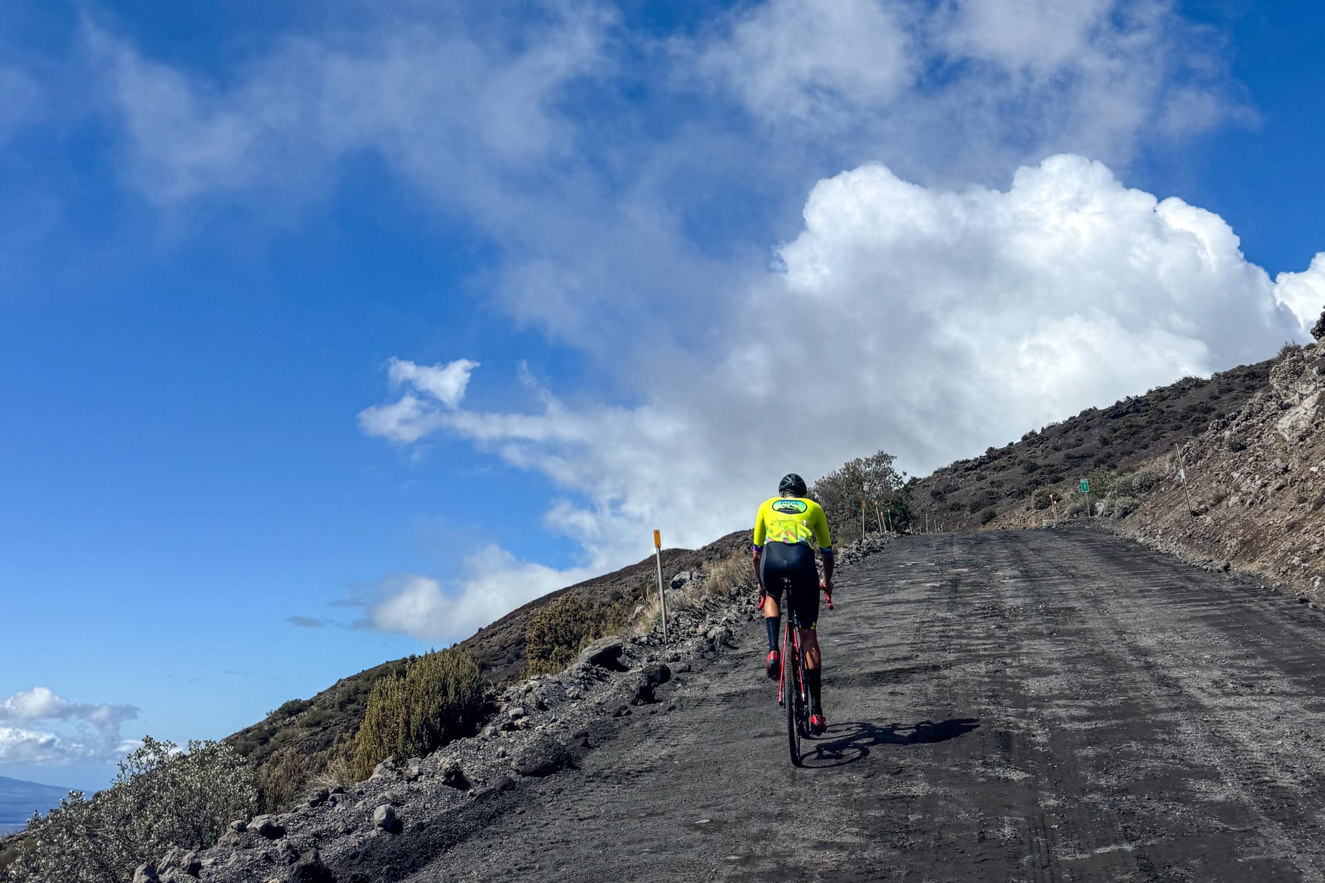
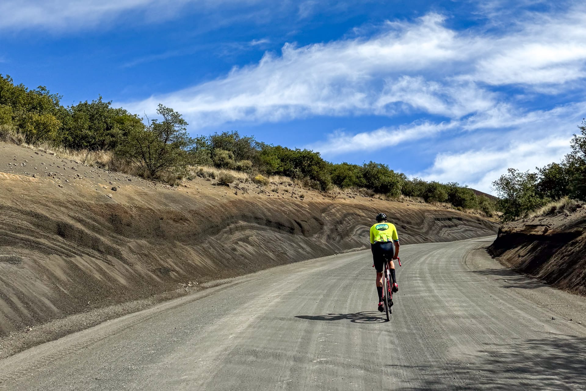
Both ascent options start on pavement but at the visitor centre (elevation 2,800 m), there is a 7.5 km section of steep, loose gravel that saps every bit of energy and inertia. The road turns back to smooth tarmac for the last 6.5-7 km and while it may seem like a reprieve, the thin air, 18-20% grades and compounding fatigue make each passing mile seem insurmountable.
Having the right gear ratio and gravel-ready wheels is essential; along with your best “paperboy” impersonation. It is not uncommon for people attempting this climb to bring a pair of runners should they need to hike-a-bike the steepest, looser sections near the summit.
I am so proud to have been able to support Dalton for his 50th birthday bucket list climb of Mauna Kea. I can confirm that in 25 years of knowing him, doing joint adventures, epic races, and silly challenges, this is by far the most he’s suffered on the bike. The day was absolutely relentless. For eight hours he endured steep grades, insane headwinds, heat, humidity, a hail storm higher up, loose gravel, a lack of oxygen, and fatigue that tested his mental and physical endurance to the max.
It was truly special to see him reach the top because it was really touch and go. A week prior he attempted the ascent from Hilo, the shorter (67 km) but steeper and hotter route. Despite the favorable weather conditions, he experienced severe altitude sickness at 3,350 meters, just beyond the visitor center. Consequently, we decided it was best to stop our climb. He was definitely not interested in trying again after that experience but we watched the weather forecast and picked another day to attempt it again, this time from Waikoloa.
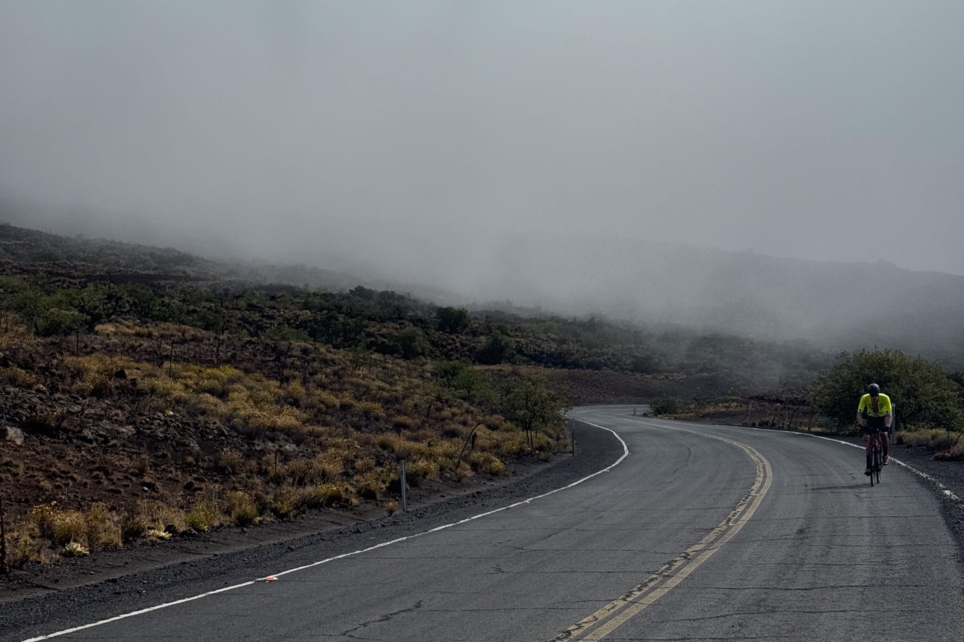
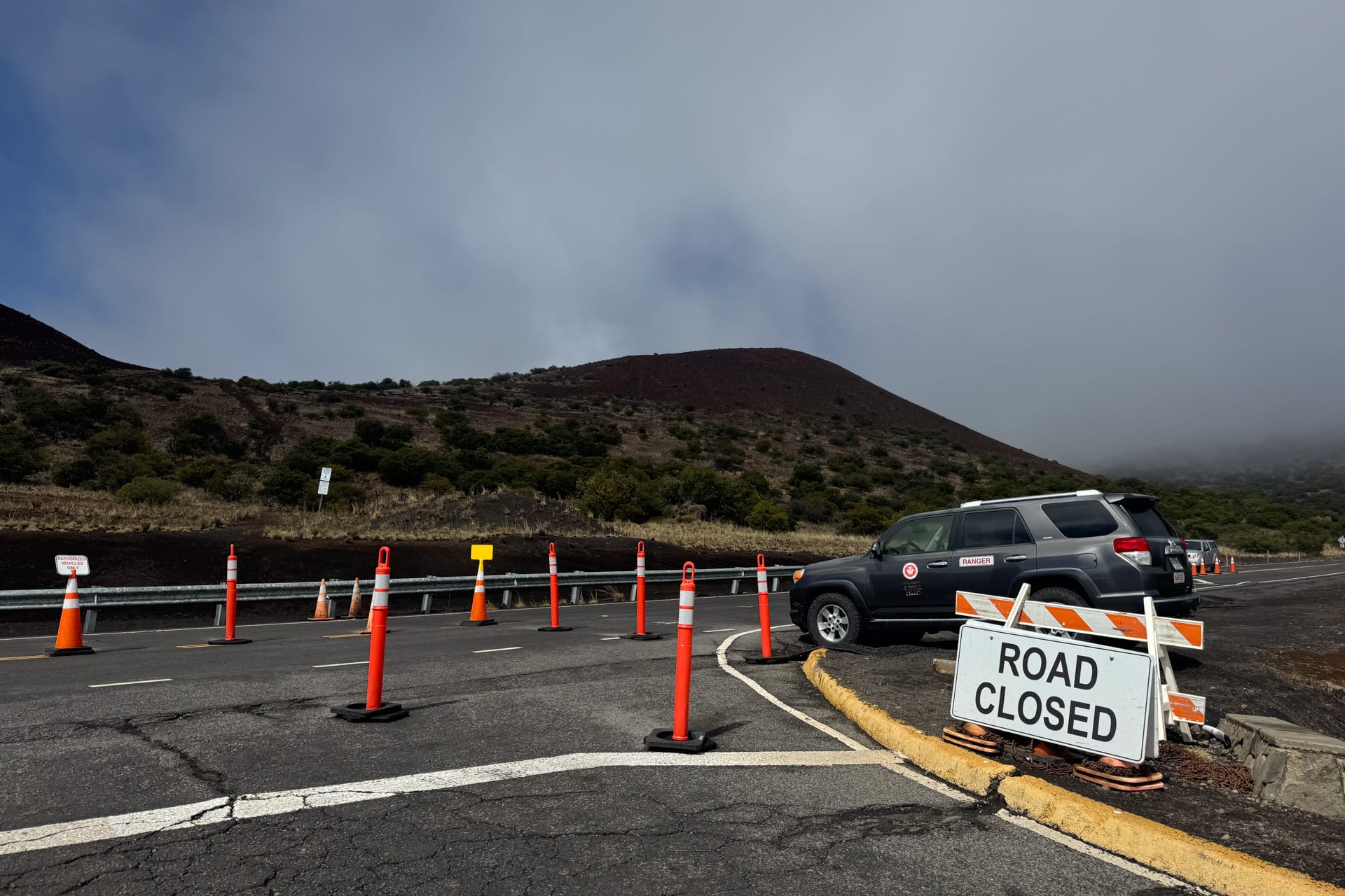
The weather was looking good until the morning of and he started the climb at 6am knowing the road past the visitor centre (and last 16 km, 2,800 m to 4,207 m) was closed. All the webcams showed that the road was covered in snow and ice, with zero visibility and dense fog. For 4.5 hours straight, the weather showed no signs of improvement.
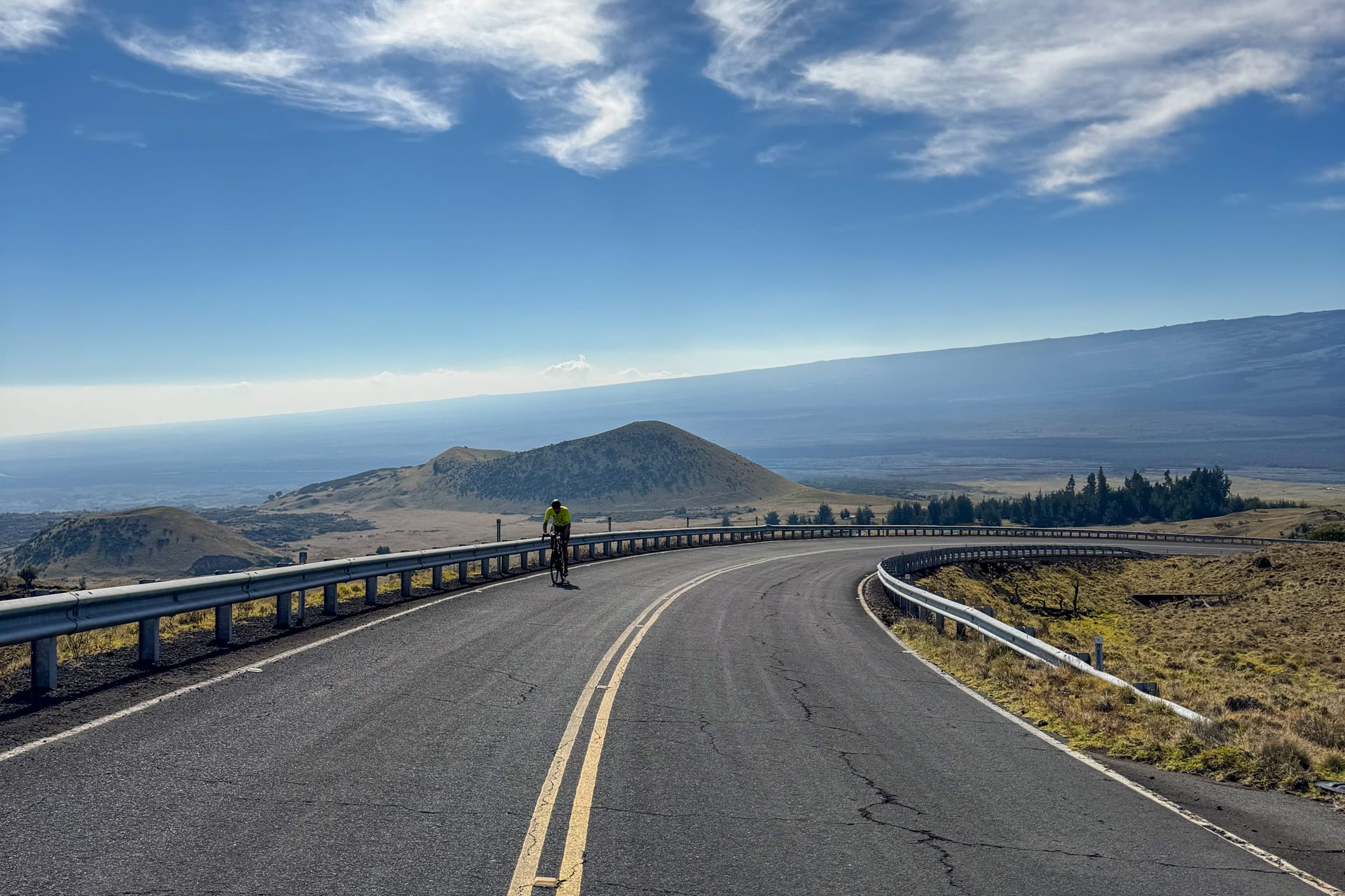
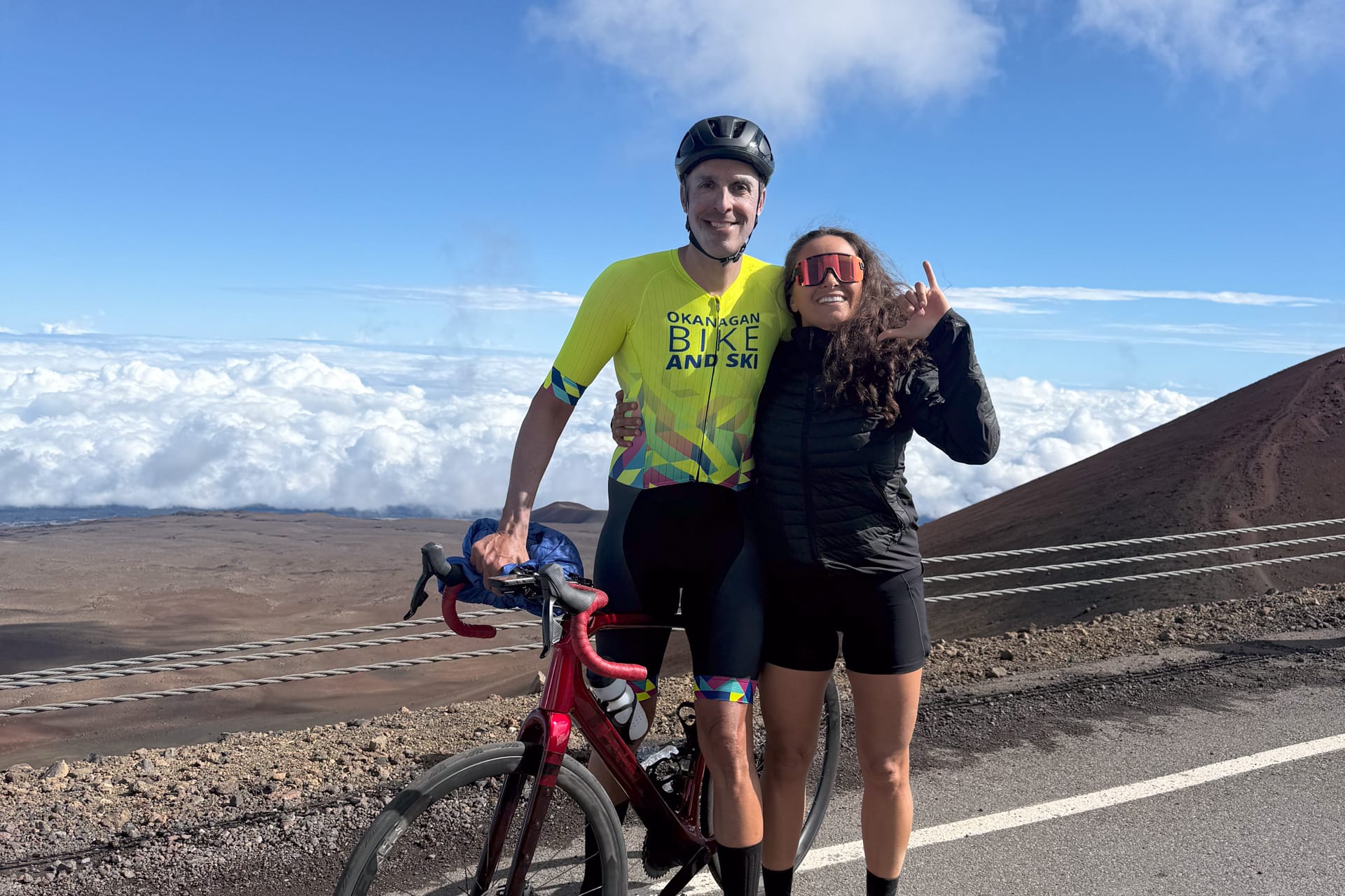
As I leapfrogged with bottles and support, I kept checking the minute-to-minute forecast hoping it would improve and they would open the road so he would get another shot at his bucket-list ride. Sure enough, as I reached the visitor station at noon, the sun emerged and completely cleared up the skies. It turned into a perfect bluebird day, with the sun melting all the snow and ice.
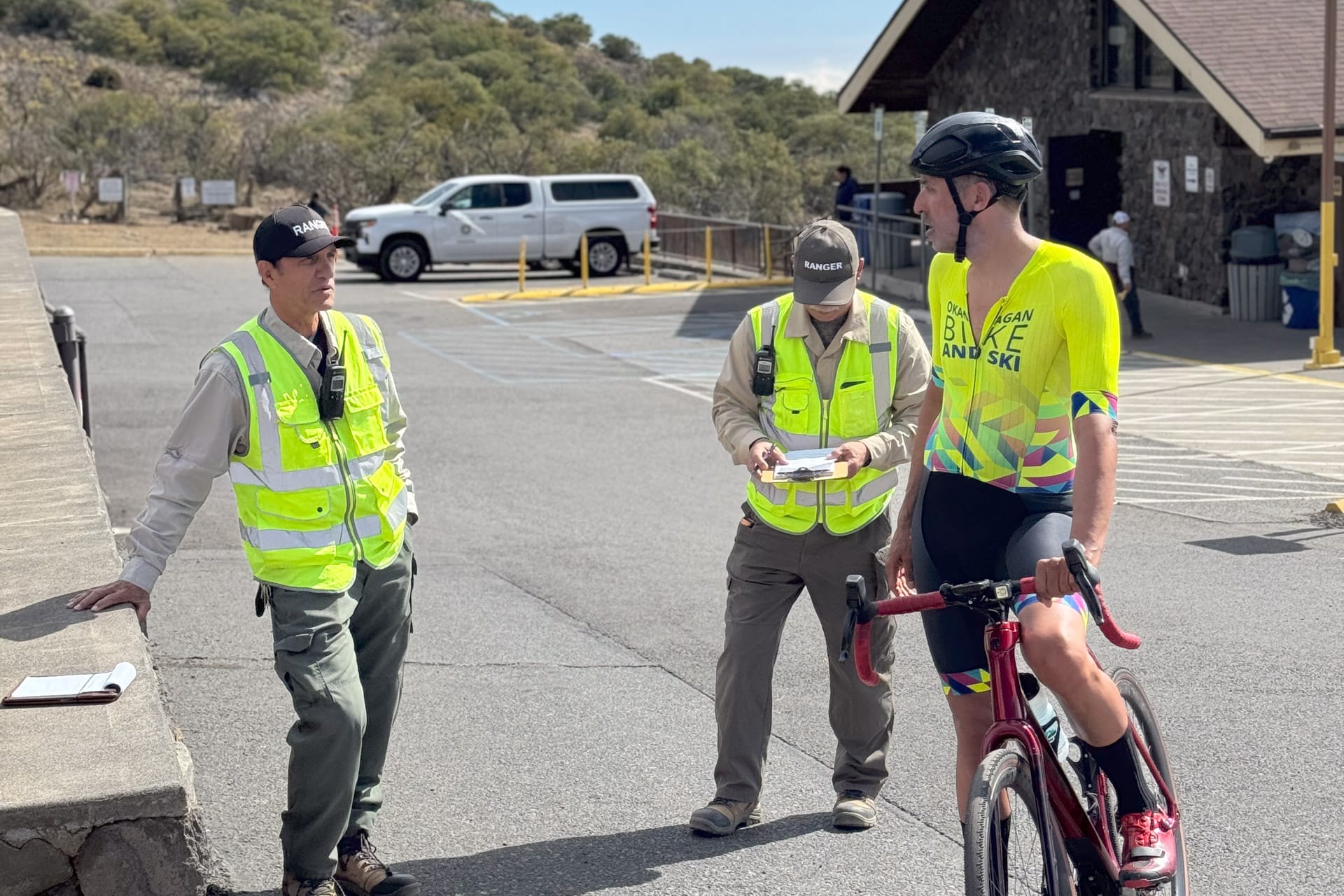
I asked the ranger what the plan was for the top section and he said it was about to open in 10 minutes. By the time Dalton arrived at the visitor station, he had been climbing for over five hours through various weather conditions, fully aware that the road was closed. I gave him the bittersweet news that it was time to switch to his gravel wheels, refuel, and press on.
One mile at the time; literally. At 3,660 m with 5.5 km remaining, Dalton began to show signs of altitude sickness, just as he had the previous week. He became extremely drowsy and started yawning while zig-zagging up the road.
Acute Mountain Sickness, caused when you ascend faster than your body can adjust to changes in atmospheric oxygen levels, is often mild but can quickly progress to potentially life-threatening complications like pulmonary or cerebral edema. Headache and slight nausea are hallmark early symptoms of mild AMS and bear monitoring by your support crew. But if you suffer severe nausea, confusion or lack of motor coordination, or tachycardia and abnormal fatigue, and which don’t lessen with brief rest and plenty of hydration, turn around and head down. If worse symptoms occur such as vomiting, blurred vision, or a bluish tinge at fingertips or lips (called cyanosis), seek medical attention immediately.
I made him stop, take a break to lower his heart rate, and consume some calories and hydration before continuing to ride. After taking the necessary precautions to rest for a few minutes and seeing an improvement in Dalton's symptoms, I felt reassured that he could safely continue the ride.
The final 2.5 km of the climb are absolutely insane. It feels like you're scaling a vertical wall and ascending straight into the stratosphere. Once he got to the 1 mile to go sign, I knew he’d make it even if it meant walking. Thankfully he didn’t, and he had company from another cyclist from Germany also attempting to summit. At 25, Julian was exactly half Dalton's age. They had gone back and forth a few times throughout the day so it was heartwarming to see them finish together.
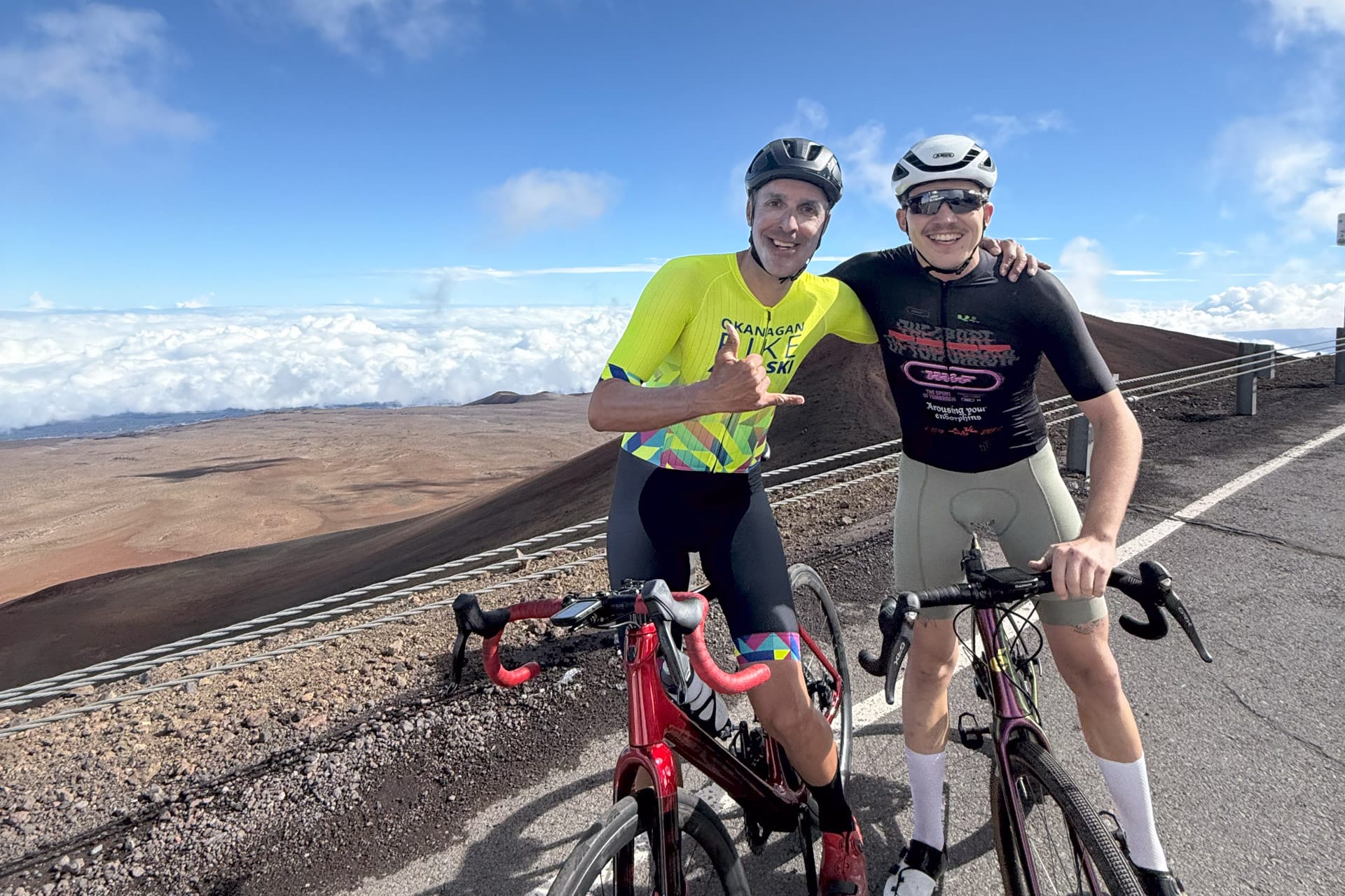
After enduring eight gruelling hours, they finally exchanged a few words, reflecting on the heroic efforts and shared experiences they had both gone through. As fate would have it, a weather system rolled in shortly after they reached the summit, closing the road for the rest of the day. Remarkably, the road remained open for exactly 3.5 hours—the precise amount of time it took them to summit Mauna Kea.
Pictures don’t do Dalton's effort justice and Strava metrics don’t tell the story, but this will definitely go down as one of our most memorable experiences together
Planning to do this ascent? Here are our top 10 tips to making your effort a successful endeavor.
- Check the weather and road conditions hourly. The window to ascend from sea level to 4,200 m is very small, and the weather changes constantly. Check out the Mauna Kea Visitor Information Station for road conditions and the Mauna Kea Weather Forecast (at 4,205 m) for hourly weather updates.
- You will need a support buddy with a 4x4 vehicle, as you're not allowed past the visitor center without one and at least three-quarters of a tank of gas. Before ascending from 2,800 m to 4,200 m, a ranger will give you a safety briefing, explaining the gear (4L/4H) you'll need to use to ensure proper traction both up and down the mountain and to prevent brake failure on the descent.
- To avoid carrying unnecessary weight, it's best to hand over extra snacks and bottles to your support buddy and have them leapfrog you with assistance. This strategy becomes especially important once you turn off the main highway and onto Mauna Kea Summit Road, where the incline becomes extremely steep!
- Your support buddy should arrive at the visitor center at least 40 minutes before you, to fill out the waiver and mandatory paperwork required for both of you to summit. The rangers need an accurate headcount of everyone past the visitor center, and you must be prepared to turn around at any point, as they can close the road on a moment's notice due to rapidly changing weather conditions on the mountain.
- Prepare to be on your bike for at least seven grueling hours. Ensure you have an adequate supply of calories and hydration, as you burn more carbs and need more fluids at higher elevations. Water access is limited, so make sure your support vehicle carries enough water and fuel for the entire day.
- Ensure you have warm gear in the support vehicle for the higher elevations. This should include a wind shell, gloves, a truly waterproof (not water-resistant) jacket (as it's almost guaranteed to rain at some point), and a puffy jacket and clothes to change into at the summit. When we started at 6AM, the temperature was 18 °C/64 °F, rising to 25 °C/77 °F, and at the top, it was -4 °C/ 25 °F. Preparing for these varied conditions will help keep you safe and comfortable throughout your climb.
- Ideally, you should rent a lightweight road bike with good rolling resistance road tires for the smoother sections and a hardtail mountain bike for the steep, loose gravel section in the middle. If that's not possible, a gravel bike with a set of road tires and separate gravel wheels will work as an alternative. Dalton had 28 mm tubeless GP5000S for paved parts and Schwalbe G- One RS tubeless tires on gravel that, when mounted to wide internal 25 mm rims, measured to 37-38 mm.
- Make sure you have low gears on your bikes! The gear ratio Dalton used was a SRAM AXS Rival groupset with 30-43 crankset and 10-36T cassette. He definitely wished he had more gears.
- Having music and a way to stay motivated during the climb can make a huge difference, especially during those slow-moving sections near the top.
- Pacing yourself and training for a massive day in the saddle is crucial. This is not a bucket-list climb to tackle on a whim. You need to train for a low cadence grind that can take 8-11 hours, at high altitude, and in all types of weather conditions. While a heart rate monitor and power meter can be helpful, those numbers can start to play mind games above 2,000 meters when the altitude and thin air affect your physiology. It may feel easy at the start, and the temptation will be to go hard and make up time – don’t fall victim to that mindset. Be prepared to suffer and endure, patiently!
Did we do a good job with this story?